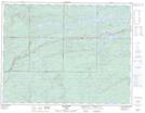
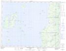
Maps showing Standingstone River, Thunder Bay, Ontario
Standingstone River is a River located in Thunder Bay, Ontario and has an elevation of 320 meters.
- Latitude: 49° 37' 58'' North (decimal: 49.6327777)
- Longitude: 88° 5' 23'' West (decimal: -88.0897222)
- Topography Feature Category: River
- Geographical Feature: River
- Canadian Province/Territory: Ontario
- Elevation: 320 meters
- Location: Thunder Bay
- Atlas of Canada Locator Map: Standingstone River
- GPS Coordinate Locator Map: Standingstone River Lat/Long
Standingstone River NTS Map Sheets