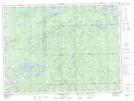
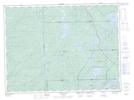
Maps showing Star Island, Algoma, Ontario
Star Island is a Island located in Algoma, Ontario and has an elevation of 439 meters.
- Latitude: 48° 15' 35'' North (decimal: 48.2597222)
- Longitude: 85° 1' 37'' West (decimal: -85.0269444)
- Topography Feature Category: Island
- Geographical Feature: Island
- Canadian Province/Territory: Ontario
- Elevation: 439 meters
- Location: Algoma
- Atlas of Canada Locator Map: Star Island
- GPS Coordinate Locator Map: Star Island Lat/Long
Star Island NTS Map Sheets