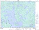
Maps showing Steamboat Shoal, Rainy River, Ontario
Steamboat Shoal is a Shoal located in Rainy River, Ontario.
- Latitude: 48° 54' 15'' North (decimal: 48.9041666)
- Longitude: 93° 20' 29'' West (decimal: -93.3413888)
- Topography Feature Category: Shoal
- Geographical Feature: Shoal
- Canadian Province/Territory: Ontario
- Location: Rainy River
- Atlas of Canada Locator Map: Steamboat Shoal
- GPS Coordinate Locator Map: Steamboat Shoal Lat/Long
Steamboat Shoal NTS Map Sheets