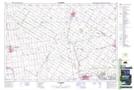
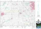
Maps showing Stratford, Perth, Ontario
Stratford is a City located in Perth, Ontario and has an elevation of 349 meters.
- Latitude: 43° 22' 21'' North (decimal: 43.3724999)
- Longitude: 80° 58' 35'' West (decimal: -80.9763888)
- Topography Feature Category: City
- Geographical Feature: City
- Canadian Province/Territory: Ontario
- Elevation: 349 meters
- Location: Perth
- Atlas of Canada Locator Map: Stratford
- GPS Coordinate Locator Map: Stratford Lat/Long
Stratford NTS Map Sheets