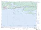
Maps showing Strong Island, Algoma, Ontario
Strong Island is a Island located in Algoma, Ontario and has an elevation of 178 meters.
- Latitude: 46° 11' 40'' North (decimal: 46.1944444)
- Longitude: 82° 42' 4'' West (decimal: -82.7011111)
- Topography Feature Category: Island
- Geographical Feature: Island
- Canadian Province/Territory: Ontario
- Elevation: 178 meters
- Location: Algoma
- Atlas of Canada Locator Map: Strong Island
- GPS Coordinate Locator Map: Strong Island Lat/Long