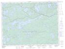
Maps showing Sunrise Point, Rainy River, Ontario
Sunrise Point is a Cape located in Rainy River, Ontario and has an elevation of 440 meters.
- Latitude: 48° 41' 42'' North (decimal: 48.6949999)
- Longitude: 91° 11' 31'' West (decimal: -91.1919444)
- Topography Feature Category: Cape
- Geographical Feature: Point
- Canadian Province/Territory: Ontario
- Elevation: 440 meters
- Location: Rainy River
- Atlas of Canada Locator Map: Sunrise Point
- GPS Coordinate Locator Map: Sunrise Point Lat/Long
Sunrise Point NTS Map Sheets