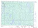
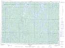
Maps showing Tasker Creek, Sudbury, Ontario
Tasker Creek is a River located in Sudbury, Ontario and has an elevation of 440 meters.
- Latitude: 47° 5' 32'' North (decimal: 47.0922222)
- Longitude: 82° 10' 32'' West (decimal: -82.1755555)
- Topography Feature Category: River
- Geographical Feature: Creek
- Canadian Province/Territory: Ontario
- Elevation: 440 meters
- Location: Sudbury
- Atlas of Canada Locator Map: Tasker Creek
- GPS Coordinate Locator Map: Tasker Creek Lat/Long
Tasker Creek NTS Map Sheets