Canada Topographic Maps

Tata River Topo Maps

Topography maps and Latitude/Longitude Location

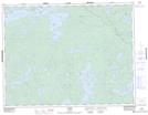
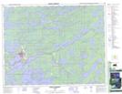
Maps showing Tata River, Ontario

Tata River is a River located in Ontario and has an elevation of 400 meters.

  • Latitude: 49° 58' 30'' North   (decimal: 49.9750000)
  • Longitude: 91° 44' 40'' West   (decimal: -91.7444000)
  • Topography Feature Category: River
  • Geographical Feature: River
  • Canadian Province/Territory: Ontario
  • Elevation: 400 meters
  • GPS Coordinate Locator Map: Tata River Lat/Long

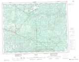
Tata River NTS Map Sheets

052G13 Yonde Topographic Map at 1:50,000 scale

052J04 Sioux Lookout Topographic Map at 1:50,000 scale

052G Ignace Topographic Map at 1:250,000 scale

052J Sioux Lookout Topographic Map at 1:250,000 scale

 
Buy Topographic Maps DVD
Newsletter Sign-up

Yes, I want to receive map store discounts.


Bookmark and Share