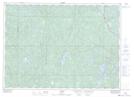
Maps showing Taylor's Island, Sudbury, Ontario
Taylor's Island is a Island located in Sudbury, Ontario and has an elevation of 355 meters.
- Latitude: 46° 33' 46'' North (decimal: 46.5627777)
- Longitude: 81° 34' 2'' West (decimal: -81.5672222)
- Topography Feature Category: Island
- Geographical Feature: Island
- Canadian Province/Territory: Ontario
- Elevation: 355 meters
- Location: Sudbury
- Atlas of Canada Locator Map: Taylor's Island
- GPS Coordinate Locator Map: Taylor's Island Lat/Long