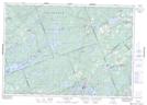
Maps showing Tay River, Lanark, Ontario
Tay River is a River located in Lanark, Ontario and has an elevation of 154 meters.
- Latitude: 44° 52' 43'' North (decimal: 44.8786111)
- Longitude: 76° 6' 46'' West (decimal: -76.1127777)
- Topography Feature Category: River
- Geographical Feature: River
- Canadian Province/Territory: Ontario
- Elevation: 154 meters
- Location: Lanark
- Atlas of Canada Locator Map: Tay River
- GPS Coordinate Locator Map: Tay River Lat/Long
Tay River NTS Map Sheets