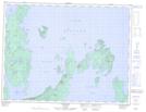
Maps showing Tchiatang Point, Thunder Bay, Ontario
Tchiatang Point is a Cape located in Thunder Bay, Ontario and has an elevation of 251 meters.
- Latitude: 49° 31' 39'' North (decimal: 49.5274999)
- Longitude: 88° 54' 50'' West (decimal: -88.9138888)
- Topography Feature Category: Cape
- Geographical Feature: Point
- Canadian Province/Territory: Ontario
- Elevation: 251 meters
- Location: Thunder Bay
- Atlas of Canada Locator Map: Tchiatang Point
- GPS Coordinate Locator Map: Tchiatang Point Lat/Long