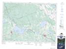
Maps showing Teapot Lake, Renfrew, Ontario
Teapot Lake is a Lake located in Renfrew, Ontario and has an elevation of 240 meters.
- Latitude: 45° 41' 18'' North (decimal: 45.6883333)
- Longitude: 77° 19' 41'' West (decimal: -77.3280555)
- Topography Feature Category: Lake
- Geographical Feature: Lake
- Canadian Province/Territory: Ontario
- Elevation: 240 meters
- Location: Renfrew
- Atlas of Canada Locator Map: Teapot Lake
- GPS Coordinate Locator Map: Teapot Lake Lat/Long
Teapot Lake NTS Map Sheets