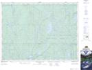
Maps showing Tent Creek, Sudbury, Ontario
Tent Creek is a River located in Sudbury, Ontario and has an elevation of 394 meters.
- Latitude: 47° 18' 27'' North (decimal: 47.3075000)
- Longitude: 80° 55' 24'' West (decimal: -80.9233333)
- Topography Feature Category: River
- Geographical Feature: Creek
- Canadian Province/Territory: Ontario
- Elevation: 394 meters
- Location: Sudbury
- Atlas of Canada Locator Map: Tent Creek
- GPS Coordinate Locator Map: Tent Creek Lat/Long
Tent Creek NTS Map Sheets