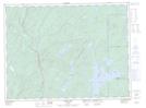
Maps showing Tent Island, Thunder Bay, Ontario
Tent Island is a Island located in Thunder Bay, Ontario and has an elevation of 326 meters.
- Latitude: 48° 47' 27'' North (decimal: 48.7908333)
- Longitude: 85° 36' 19'' West (decimal: -85.6052777)
- Topography Feature Category: Island
- Geographical Feature: Island
- Canadian Province/Territory: Ontario
- Elevation: 326 meters
- Location: Thunder Bay
- Atlas of Canada Locator Map: Tent Island
- GPS Coordinate Locator Map: Tent Island Lat/Long
Tent Island NTS Map Sheets