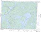
Maps showing Tetu Lake, Kenora, Ontario
Tetu Lake is a Lake located in Kenora, Ontario and has an elevation of 302 meters.
- Latitude: 50° 10' 58'' North (decimal: 50.1827777)
- Longitude: 95° 2' 11'' West (decimal: -95.0363888)
- Topography Feature Category: Lake
- Geographical Feature: Lake
- Canadian Province/Territory: Ontario
- Elevation: 302 meters
- Location: Kenora
- Atlas of Canada Locator Map: Tetu Lake
- GPS Coordinate Locator Map: Tetu Lake Lat/Long
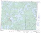
Tetu Lake NTS Map Sheets