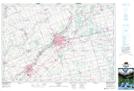
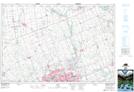
Maps showing Thamesford, Oxford, Ontario
Thamesford is a Unincorporated area located in Oxford, Ontario and has an elevation of 277 meters.
- Latitude: 43° 3' 27'' North (decimal: 43.0574999)
- Longitude: 81° 0' 8'' West (decimal: -81.0022222)
- Topography Feature Category: Unincorporated area
- Geographical Feature: Compact Rural Community
- Canadian Province/Territory: Ontario
- Elevation: 277 meters
- Location: Oxford
- Atlas of Canada Locator Map: Thamesford
- GPS Coordinate Locator Map: Thamesford Lat/Long
Thamesford NTS Map Sheets