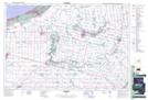
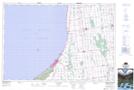
Maps showing Thedford Marsh, Lambton; Huron; Middlesex, Ontario
Thedford Marsh is a Low vegetation located in Lambton; Huron; Middlesex, Ontario and has an elevation of 181 meters.
- Latitude: 43° 13' 38'' North (decimal: 43.2272222)
- Longitude: 81° 49' 8'' West (decimal: -81.8188888)
- Topography Feature Category: Low vegetation
- Geographical Feature: Marsh
- Canadian Province/Territory: Ontario
- Elevation: 181 meters
- Location: Lambton; Huron; Middlesex
- Atlas of Canada Locator Map: Thedford Marsh
- GPS Coordinate Locator Map: Thedford Marsh Lat/Long
Thedford Marsh NTS Map Sheets