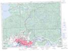
Maps showing The P Patch, Algoma, Ontario
The P Patch is a Unincorporated area located in Algoma, Ontario and has an elevation of 223 meters.
- Latitude: 46° 31' 36'' North (decimal: 46.5266666)
- Longitude: 84° 18' 7'' West (decimal: -84.3019444)
- Topography Feature Category: Unincorporated area
- Geographical Feature: Urban Community
- Canadian Province/Territory: Ontario
- Elevation: 223 meters
- Location: Algoma
- Atlas of Canada Locator Map: The P Patch
- GPS Coordinate Locator Map: The P Patch Lat/Long
The P Patch NTS Map Sheets