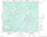
Maps showing Thorne River, Kenora, Ontario
Thorne River is a River located in Kenora, Ontario.
- Latitude: 54° 55' 48'' North (decimal: 54.9300000)
- Longitude: 90° 36' 7'' West (decimal: -90.6019444)
- Topography Feature Category: River
- Geographical Feature: River
- Canadian Province/Territory: Ontario
- Location: Kenora
- Atlas of Canada Locator Map: Thorne River
- GPS Coordinate Locator Map: Thorne River Lat/Long
Thorne River NTS Map Sheets
053J11 Sherman River Topographic Map at 1:50,000 scale
053J12 Ellard Lake Topographic Map at 1:50,000 scale
053J15 No Title Topographic Map at 1:50,000 scale
053J Thorne River Topographic Map at 1:250,000 scale
053K Stull Lake Topographic Map at 1:250,000 scale
053J12 Ellard Lake Topographic Map at 1:50,000 scale
053J15 No Title Topographic Map at 1:50,000 scale
053J Thorne River Topographic Map at 1:250,000 scale
053K Stull Lake Topographic Map at 1:250,000 scale