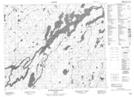
Maps showing Throop Creek, Kenora, Ontario
Throop Creek is a River located in Kenora, Ontario and has an elevation of 267 meters.
- Latitude: 53° 26' 2'' North (decimal: 53.4338888)
- Longitude: 91° 35' 31'' West (decimal: -91.5919444)
- Topography Feature Category: River
- Geographical Feature: Creek
- Canadian Province/Territory: Ontario
- Elevation: 267 meters
- Location: Kenora
- Atlas of Canada Locator Map: Throop Creek
- GPS Coordinate Locator Map: Throop Creek Lat/Long
Throop Creek NTS Map Sheets