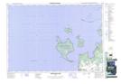
Maps showing Thunder Beach, Simcoe, Ontario
Thunder Beach is a Unincorporated area located in Simcoe, Ontario and has an elevation of 198 meters.
- Latitude: 44° 48' 22'' North (decimal: 44.8061111)
- Longitude: 80° 4' 34'' West (decimal: -80.0761111)
- Topography Feature Category: Unincorporated area
- Geographical Feature: Compact Rural Community
- Canadian Province/Territory: Ontario
- Elevation: 198 meters
- Location: Simcoe
- Atlas of Canada Locator Map: Thunder Beach
- GPS Coordinate Locator Map: Thunder Beach Lat/Long
Thunder Beach NTS Map Sheets