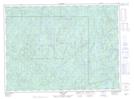
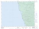
Maps showing Tip Top Mountain, Thunder Bay, Ontario
Tip Top Mountain is a Mountain located in Thunder Bay, Ontario and has an elevation of 565 meters.
- Latitude: 48° 16' 24'' North (decimal: 48.2733333)
- Longitude: 86° 0' 14'' West (decimal: -86.0038888)
- Topography Feature Category: Mountain
- Geographical Feature: Mountain
- Canadian Province/Territory: Ontario
- Elevation: 565 meters
- Location: Thunder Bay
- Atlas of Canada Locator Map: Tip Top Mountain
- GPS Coordinate Locator Map: Tip Top Mountain Lat/Long
Tip Top Mountain NTS Map Sheets