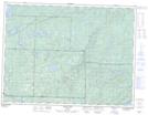
Maps showing Toivold Island, Thunder Bay, Ontario
Toivold Island is a Island located in Thunder Bay, Ontario.
- Latitude: 48° 36' 51'' North (decimal: 48.6141666)
- Longitude: 89° 20' 13'' West (decimal: -89.3369444)
- Topography Feature Category: Island
- Geographical Feature: Island
- Canadian Province/Territory: Ontario
- Location: Thunder Bay
- Atlas of Canada Locator Map: Toivold Island
- GPS Coordinate Locator Map: Toivold Island Lat/Long
Toivold Island NTS Map Sheets