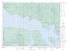
Maps showing Tracy Shoal, Thunder Bay, Ontario
Tracy Shoal is a Shoal located in Thunder Bay, Ontario.
- Latitude: 48° 47' 39'' North (decimal: 48.7941666)
- Longitude: 87° 32' 6'' West (decimal: -87.5349999)
- Topography Feature Category: Shoal
- Geographical Feature: Shoal
- Canadian Province/Territory: Ontario
- Location: Thunder Bay
- Atlas of Canada Locator Map: Tracy Shoal
- GPS Coordinate Locator Map: Tracy Shoal Lat/Long