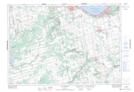
Maps showing The Traps, Grey, Ontario
The Traps is a Low vegetation located in Grey, Ontario and has an elevation of 435 meters.
- Latitude: 44° 18' 18'' North (decimal: 44.3050000)
- Longitude: 80° 29' 00'' West (decimal: -80.4833333)
- Topography Feature Category: Low vegetation
- Geographical Feature: Marsh
- Canadian Province/Territory: Ontario
- Elevation: 435 meters
- Location: Grey
- Atlas of Canada Locator Map: The Traps
- GPS Coordinate Locator Map: The Traps Lat/Long
The Traps NTS Map Sheets