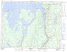
Maps showing Treasure Island, Thunder Bay, Ontario
Treasure Island is a Island located in Thunder Bay, Ontario and has an elevation of 274 meters.
- Latitude: 49° 28' 5'' North (decimal: 49.4680555)
- Longitude: 88° 12' 3'' West (decimal: -88.2008333)
- Topography Feature Category: Island
- Geographical Feature: Island
- Canadian Province/Territory: Ontario
- Elevation: 274 meters
- Location: Thunder Bay
- Atlas of Canada Locator Map: Treasure Island
- GPS Coordinate Locator Map: Treasure Island Lat/Long