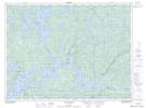
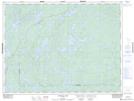
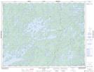
Maps showing Trout River, Rainy River, Ontario
Trout River is a River located in Rainy River, Ontario and has an elevation of 408 meters.
- Latitude: 48° 51' 24'' North (decimal: 48.8566666)
- Longitude: 92° 48' 11'' West (decimal: -92.8030555)
- Topography Feature Category: River
- Geographical Feature: River
- Canadian Province/Territory: Ontario
- Elevation: 408 meters
- Location: Rainy River
- Atlas of Canada Locator Map: Trout River
- GPS Coordinate Locator Map: Trout River Lat/Long
Trout River NTS Map Sheets