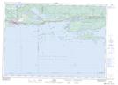
Maps showing Tug Reef, Algoma, Ontario
Tug Reef is a Shoal located in Algoma, Ontario and has an elevation of 176 meters.
- Latitude: 46° 8' 26'' North (decimal: 46.1405555)
- Longitude: 82° 44' 3'' West (decimal: -82.7341666)
- Topography Feature Category: Shoal
- Geographical Feature: Reef
- Canadian Province/Territory: Ontario
- Elevation: 176 meters
- Location: Algoma
- Atlas of Canada Locator Map: Tug Reef
- GPS Coordinate Locator Map: Tug Reef Lat/Long