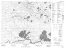
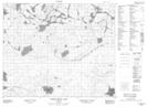
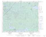
Maps showing Tullibee Lake, Kenora, Ontario
Tullibee Lake is a Lake located in Kenora, Ontario and has an elevation of 268 meters.
- Latitude: 53° 28' 41'' North (decimal: 53.4780555)
- Longitude: 93° 29' 49'' West (decimal: -93.4969444)
- Topography Feature Category: Lake
- Geographical Feature: Lake
- Canadian Province/Territory: Ontario
- Elevation: 268 meters
- Location: Kenora
- Atlas of Canada Locator Map: Tullibee Lake
- GPS Coordinate Locator Map: Tullibee Lake Lat/Long
Tullibee Lake NTS Map Sheets