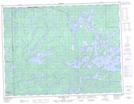
Maps showing Tunnel Island, Ontario
Tunnel Island is a Island located in Ontario.
- Latitude: 48° 49' North (decimal: 48.8166999)
- Longitude: 90° 30' West (decimal: -90.4999999)
- Topography Feature Category: Island
- Geographical Feature: Island
- Canadian Province/Territory: Ontario
- GPS Coordinate Locator Map: Tunnel Island Lat/Long
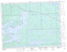
Tunnel Island NTS Map Sheets