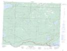
Maps showing The Tunnel, Thunder Bay, Ontario
The Tunnel is a Falls located in Thunder Bay, Ontario.
- Latitude: 48° 0' 48'' North (decimal: 48.0133333)
- Longitude: 89° 43' 00'' West (decimal: -89.7166666)
- Topography Feature Category: Falls
- Geographical Feature: Falls
- Canadian Province/Territory: Ontario
- Location: Thunder Bay
- Atlas of Canada Locator Map: The Tunnel
- GPS Coordinate Locator Map: The Tunnel Lat/Long
The Tunnel NTS Map Sheets