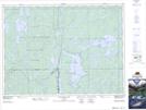
Maps showing Turner Lake, Timiskaming, Ontario
Turner Lake is a Lake located in Timiskaming, Ontario and has an elevation of 332 meters.
- Latitude: 47° 16' 57'' North (decimal: 47.2825000)
- Longitude: 80° 4' 52'' West (decimal: -80.0811111)
- Topography Feature Category: Lake
- Geographical Feature: Lake
- Canadian Province/Territory: Ontario
- Elevation: 332 meters
- Location: Timiskaming
- Atlas of Canada Locator Map: Turner Lake
- GPS Coordinate Locator Map: Turner Lake Lat/Long
Turner Lake NTS Map Sheets