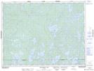
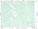
Maps showing Turtle River, Kenora, Ontario
Turtle River is a River located in Kenora, Ontario and has an elevation of 395 meters.
- Latitude: 49° 2' 9'' North (decimal: 49.0358333)
- Longitude: 92° 23' 51'' West (decimal: -92.3975000)
- Topography Feature Category: River
- Geographical Feature: River
- Canadian Province/Territory: Ontario
- Elevation: 395 meters
- Location: Kenora
- Atlas of Canada Locator Map: Turtle River
- GPS Coordinate Locator Map: Turtle River Lat/Long
Turtle River NTS Map Sheets