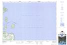
Maps showing Twelve Fathom Bank, Grey, Ontario
Twelve Fathom Bank is a Shoal located in Grey, Ontario.
- Latitude: 44° 46' 42'' North (decimal: 44.7783333)
- Longitude: 80° 41' 47'' West (decimal: -80.6963888)
- Topography Feature Category: Shoal
- Geographical Feature: Bank
- Canadian Province/Territory: Ontario
- Location: Grey
- Atlas of Canada Locator Map: Twelve Fathom Bank
- GPS Coordinate Locator Map: Twelve Fathom Bank Lat/Long
Twelve Fathom Bank NTS Map Sheets