Maps showing Uhthoff, Simcoe, Ontario
Uhthoff is a Unincorporated area located in Simcoe, Ontario and has an elevation of 213 meters.
- Latitude: 44° 41' 30'' North (decimal: 44.6916666)
- Longitude: 79° 29' 25'' West (decimal: -79.4902776)
- Topography Feature Category: Unincorporated area
- Geographical Feature: Railway Point
- Canadian Province/Territory: Ontario
- Elevation: 213 meters
- Location: Simcoe
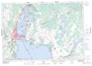
- Atlas of Canada Locator Map: Uhthoff
- GPS Coordinate Locator Map: Uhthoff Lat/Long
Uhthoff NTS Map Sheets