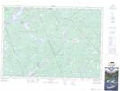
Maps showing Umpherston Meadow, Ontario
Umpherston Meadow is a Low vegetation located in Ontario.
- Latitude: 45° 4' North (decimal: 45.0666999)
- Longitude: 76° 40' West (decimal: -76.6666999)
- Topography Feature Category: Low vegetation
- Geographical Feature: Meadow
- Canadian Province/Territory: Ontario
- GPS Coordinate Locator Map: Umpherston Meadow Lat/Long
Umpherston Meadow NTS Map Sheets