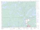
Maps showing Upper Basin A, Rainy River, Ontario
Upper Basin A is a Lake located in Rainy River, Ontario and has an elevation of 412 meters.
- Latitude: 48° 49' 47'' North (decimal: 48.8297222)
- Longitude: 91° 34' 55'' West (decimal: -91.5819444)
- Topography Feature Category: Lake
- Geographical Feature: Basin
- Canadian Province/Territory: Ontario
- Elevation: 412 meters
- Location: Rainy River
- Atlas of Canada Locator Map: Upper Basin A
- GPS Coordinate Locator Map: Upper Basin A Lat/Long