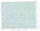
Maps showing Upper Seine Bay, Rainy River, Ontario
Upper Seine Bay is a Bay located in Rainy River, Ontario and has an elevation of 417 meters.
- Latitude: 48° 55' 00'' North (decimal: 48.9166666)
- Longitude: 91° 18' 29'' West (decimal: -91.3080555)
- Topography Feature Category: Bay
- Geographical Feature: Bay
- Canadian Province/Territory: Ontario
- Elevation: 417 meters
- Location: Rainy River
- Atlas of Canada Locator Map: Upper Seine Bay
- GPS Coordinate Locator Map: Upper Seine Bay Lat/Long