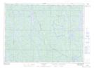
Maps showing Upper Shakwa Lake, Algoma, Ontario
Upper Shakwa Lake is a Lake located in Algoma, Ontario and has an elevation of 446 meters.
- Latitude: 46° 48' 40'' North (decimal: 46.8111111)
- Longitude: 81° 57' 56'' West (decimal: -81.9655555)
- Topography Feature Category: Lake
- Geographical Feature: Lake
- Canadian Province/Territory: Ontario
- Elevation: 446 meters
- Location: Algoma
- Atlas of Canada Locator Map: Upper Shakwa Lake
- GPS Coordinate Locator Map: Upper Shakwa Lake Lat/Long