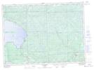
Maps showing Upper Sheppard Lake, Algoma, Ontario
Upper Sheppard Lake is a Lake located in Algoma, Ontario and has an elevation of 429 meters.
- Latitude: 46° 51' 38'' North (decimal: 46.8605555)
- Longitude: 84° 13' 34'' West (decimal: -84.2261111)
- Topography Feature Category: Lake
- Geographical Feature: Lake
- Canadian Province/Territory: Ontario
- Elevation: 429 meters
- Location: Algoma
- Atlas of Canada Locator Map: Upper Sheppard Lake
- GPS Coordinate Locator Map: Upper Sheppard Lake Lat/Long
Upper Sheppard Lake NTS Map Sheets