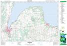
Maps showing Vail's Point, Grey, Ontario
Vail's Point is a Cape located in Grey, Ontario and has an elevation of 180 meters.
- Latitude: 44° 43' 33'' North (decimal: 44.7258333)
- Longitude: 80° 45' 10'' West (decimal: -80.7527777)
- Topography Feature Category: Cape
- Geographical Feature: Point
- Canadian Province/Territory: Ontario
- Elevation: 180 meters
- Location: Grey
- Atlas of Canada Locator Map: Vail's Point
- GPS Coordinate Locator Map: Vail's Point Lat/Long
Vail's Point NTS Map Sheets