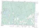
Maps showing Vansickle, Peterborough; Hastings, Ontario
Vansickle is a Unincorporated area located in Peterborough; Hastings, Ontario and has an elevation of 258 meters.
- Latitude: 44° 37' 1'' North (decimal: 44.6169444)
- Longitude: 77° 49' 19'' West (decimal: -77.8219444)
- Topography Feature Category: Unincorporated area
- Geographical Feature: Dispersed Rural Community
- Canadian Province/Territory: Ontario
- Elevation: 258 meters
- Location: Peterborough; Hastings
- Atlas of Canada Locator Map: Vansickle
- GPS Coordinate Locator Map: Vansickle Lat/Long
Vansickle NTS Map Sheets