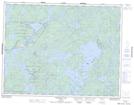
Maps showing Vermilion Island, Kenora, Ontario
Vermilion Island is a Island located in Kenora, Ontario and has an elevation of 330 meters.
- Latitude: 50° 2' 32'' North (decimal: 50.0422222)
- Longitude: 94° 38' 56'' West (decimal: -94.6488888)
- Topography Feature Category: Island
- Geographical Feature: Island
- Canadian Province/Territory: Ontario
- Elevation: 330 meters
- Location: Kenora
- Atlas of Canada Locator Map: Vermilion Island
- GPS Coordinate Locator Map: Vermilion Island Lat/Long
Vermilion Island NTS Map Sheets