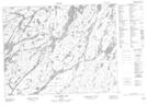
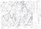
Maps showing Vincent Lake, Kenora; Thunder Bay, Ontario
Vincent Lake is a Lake located in Kenora; Thunder Bay, Ontario and has an elevation of 399 meters.
- Latitude: 50° 38' 10'' North (decimal: 50.6361111)
- Longitude: 90° 58' 47'' West (decimal: -90.9797222)
- Topography Feature Category: Lake
- Geographical Feature: Lake
- Canadian Province/Territory: Ontario
- Elevation: 399 meters
- Location: Kenora; Thunder Bay
- Atlas of Canada Locator Map: Vincent Lake
- GPS Coordinate Locator Map: Vincent Lake Lat/Long
Vincent Lake NTS Map Sheets