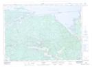
Maps showing Wade's Landing, Parry Sound, Ontario
Wade's Landing is a Unincorporated area located in Parry Sound, Ontario and has an elevation of 212 meters.
- Latitude: 46° 7' 6'' North (decimal: 46.1183333)
- Longitude: 79° 31' 42'' West (decimal: -79.5283333)
- Topography Feature Category: Unincorporated area
- Geographical Feature: Dispersed Rural Community
- Canadian Province/Territory: Ontario
- Elevation: 212 meters
- Location: Parry Sound
- Atlas of Canada Locator Map: Wade's Landing
- GPS Coordinate Locator Map: Wade's Landing Lat/Long
Wade's Landing NTS Map Sheets