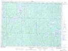
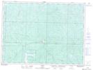
Maps showing Wakami Lake Provincial Park, Sudbury, Ontario
Wakami Lake Provincial Park is a Conservation area located in Sudbury, Ontario and has an elevation of 483 meters.
- Latitude: 47° 29' 20'' North (decimal: 47.4888888)
- Longitude: 82° 49' 57'' West (decimal: -82.8324999)
- Topography Feature Category: Conservation area
- Geographical Feature: Provincial Park
- Canadian Province/Territory: Ontario
- Elevation: 483 meters
- Location: Sudbury
- Atlas of Canada Locator Map: Wakami Lake Provincial Park
- GPS Coordinate Locator Map: Wakami Lake Provincial Park Lat/Long
Wakami Lake Provincial Park NTS Map Sheets