Canada Topographic Maps

Wakwayowkastic River Topo Maps

Topography maps and Latitude/Longitude Location

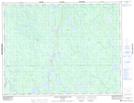
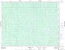
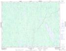
Maps showing Wakwayowkastic River, Ontario

Wakwayowkastic River is a River located in Ontario and has an elevation of 64 meters.

  • Latitude: 50° 43' North   (decimal: 50.7166999)
  • Longitude: 80° 56' West   (decimal: -80.9332999)
  • Topography Feature Category: River
  • Geographical Feature: River
  • Canadian Province/Territory: Ontario
  • Elevation: 64 meters
  • GPS Coordinate Locator Map: Wakwayowkastic River Lat/Long

Wakwayowkastic River NTS Map Sheets

042H09 North Burntbush Lake Topographic Map at 1:50,000 scale

042H15 Tomorrow Lake Topographic Map at 1:50,000 scale

042H16 Lawagamau Lake Topographic Map at 1:50,000 scale

042I02 Mcparlon Lake Topographic Map at 1:50,000 scale

042I07 Wekweyaukastik Rapids Topographic Map at 1:50,000 scale

042I10 Kiasko River Topographic Map at 1:50,000 scale

042H Cochrane Topographic Map at 1:250,000 scale

042I Moose River Topographic Map at 1:250,000 scale

 
Buy Topographic Maps DVD
Newsletter Sign-up

Yes, I want to receive map store discounts.


Bookmark and Share