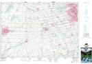
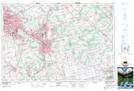
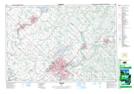
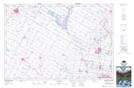
Maps showing Waterloo, Waterloo, Ontario
Waterloo is a City located in Waterloo, Ontario and has an elevation of 337 meters.
- Latitude: 43° 28' 47'' North (decimal: 43.4797222)
- Longitude: 80° 32' 28'' West (decimal: -80.5411111)
- Topography Feature Category: City
- Geographical Feature: City
- Canadian Province/Territory: Ontario
- Elevation: 337 meters
- Location: Waterloo
- Atlas of Canada Locator Map: Waterloo
- GPS Coordinate Locator Map: Waterloo Lat/Long
Waterloo NTS Map Sheets