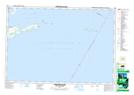
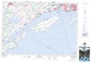
Maps showing Waupoos Island, Lennox and Addington, Ontario
Waupoos Island is a Island located in Lennox and Addington, Ontario and has an elevation of 88 meters.
- Latitude: 44° 9' 57'' North (decimal: 44.1658333)
- Longitude: 76° 55' 3'' West (decimal: -76.9174999)
- Topography Feature Category: Island
- Geographical Feature: Island
- Canadian Province/Territory: Ontario
- Elevation: 88 meters
- Location: Lennox and Addington
- Atlas of Canada Locator Map: Waupoos Island
- GPS Coordinate Locator Map: Waupoos Island Lat/Long
Waupoos Island NTS Map Sheets