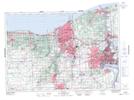
Maps showing Welland Canal, Welland; Lincoln, Ontario
Welland Canal is a Marine navigation feature located in Welland; Lincoln, Ontario and has an elevation of 175 meters.
- Latitude: 43° 2' 34'' North (decimal: 43.0427777)
- Longitude: 79° 12' 45'' West (decimal: -79.2124999)
- Topography Feature Category: Marine navigation feature
- Geographical Feature: Canal
- Canadian Province/Territory: Ontario
- Elevation: 175 meters
- Location: Welland; Lincoln
- Atlas of Canada Locator Map: Welland Canal
- GPS Coordinate Locator Map: Welland Canal Lat/Long
Welland Canal NTS Map Sheets